Build the real world in Minecraft – from your own GIS data.




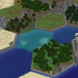
TifWorldGen replaces vanilla world generation with your own GIS data. Feed it a heightmap of your country, region or city and it builds a 1:1 Minecraft world – hills, valleys, rivers, lakes and real forest coverage – powered by the industry-standard GDAL library (a fully offline GeoTIFF file reader).
Built and tested on a full real-world dataset: parts of the Slovakia DMR terrain model (73,000 × 48,000 blocks, 14 GB GeoTIFF).
TifWorldGen collects nothing – no telemetry, no analytics, no network access of any kind. It only reads the map files (GeoTIFF heightmaps/water/forest masks) that you select yourself in the in-game config screen, and it works fully offline. "GIS" in this description refers only to those local input map files.
/tifworldgen dhpregen fills DH with terrain, rivers and trees without generating real chunks1. Install Forge 47.x for Minecraft 1.20.1 and drop both jars into mods/:tifworldgen-<version>.jar + tifworldgen-lib-<version>.jar
2. Install dependencies:
| Mod | Required | Why |
|---|---|---|
| Serene Seasons (+ GlitchCore) | ✅ Yes | seasonal snow line integration |
| Distant Horizons | 🔵 Optional | LOD pregeneration |
| Snow! Real Magic | 🔵 Optional | nicer snow stacking |
3. GDAL native libraries (the offline GeoTIFF map-file reader – pick your platform):
release-1929-x64-gdal-3-12-1-mapserver-8-6-0).minecraft/tifworldgen/native/Win/ (must contain gdal.dll + gdalalljni.dll + ~40 DLLs; subfolders are scanned; a README with instructions is generated there on first launch)sudo apt install gdal-bin (+ libgdal-java if the version differs)sudo dnf install gdal (+ gdal-java if the version differs)sudo pacman -S gdallibgdalalljni.so (from the GitHub repository root) and drop it into .minecraft/tifworldgen/native/Linux/.libgdal-java / gdal-java package, which always matches your GDAL version.).minecraft/tifworldgen/native/Linux/ on first launch4. Create a new world → world type “Tif World Map” → press O to import your maps
| Map | Format | Notes |
|---|---|---|
| Heightmap | Float32 GeoTIFF | 1 px = 1 block ideal; min/max auto-detected |
| Water mask | Byte GeoTIFF | white (≥128) = water |
| Forest/biome map | classes 0/1/2 or RGB | auto-scaled to heightmap resolution; Bit or HEX rules |
| Command | Description |
|---|---|
/tifworldgen dhpregen radius <1–4000> |
set LOD pregeneration radius |
/tifworldgen dhpregen genaboveylevel <Y> |
pregenerate only above a height |
/tifworldgen dhpregen prepare / start / stop |
run LOD pregeneration |
/tifworldgen sereneseason status |
current season & freeze line |
Built on GDAL · Distant Horizons LOD integration · Serene Seasons compatibility · Snow! Real Magic · terrain test data: Slovakia DMR.
If you enjoy the mod, please consider supporting development as I am a single developer:

All Rights Reserved.